The Smart Transportation Infrastructure Management (STIM) Lab has been established by the Ingram School of Engineering at Texas State University to have a state of the art laboratory facility to support the teaching of smart infrastructure courses for undergraduate and graduate degree programs of the Civil Engineering Program that is uniquely designed with the Technology Enhanced Infrastructure (TEI) focus. The STIM lab also serves as a platform to support our research team to conduct cutting edge innovative research in the areas of automated pavement condition survey, pavement management systems (PMS), and smart transportation infrastructure. The STIM lab is composed of expensive hardware and software such as 3D cameras, laser sensors, GPS reference, DMI, high-performance computers, and related subsystems for a vehicle borne surveying system that can conduct state of the practice automated pavement condition assessments of surface distresses such as cracking and profile features such as roughness and rutting at highway speeds. The surveying system can be used for the state of practice automated distress measurements or surveys for transportation infrastructures such as highway pavements in a state highway agency. In addition, image processing based pavement measurement modules and systems, and computer stations with high computing performance and powerful GPU and image processing capacity are available in the lab. The STIM lab has been a solid foundation to support the research team to conduct innovative research projects such as “Improve data quality for automated pavement distress data collection,” “Artificial Intelligence for Pavement Condition Assessment from 2D/3D Surface Images,” and “Using artificial intelligence to improve the accuracy of automated pavement condition data collection,” funded by the Texas Department of Transportation and the National Science Foundation. The STIM lab resources not only enable the research team to develop a well-rounded research program which is capable of studying multiple areas of automated pavement data collection and 3D image processing technologies at both the applied and basic research levels, the lab facilities also serve the function of attracting K-12 students to transportation majors, prepare the next generation engineers and researchers for our future transportation systems, and expose the students to the interdisciplinary and diversified education environments.
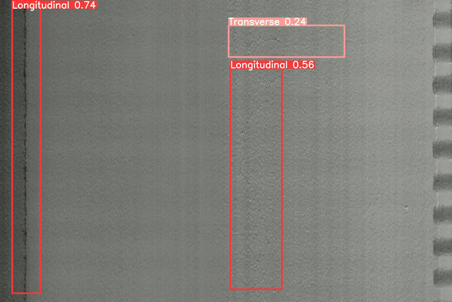
Automated pavement crack detection
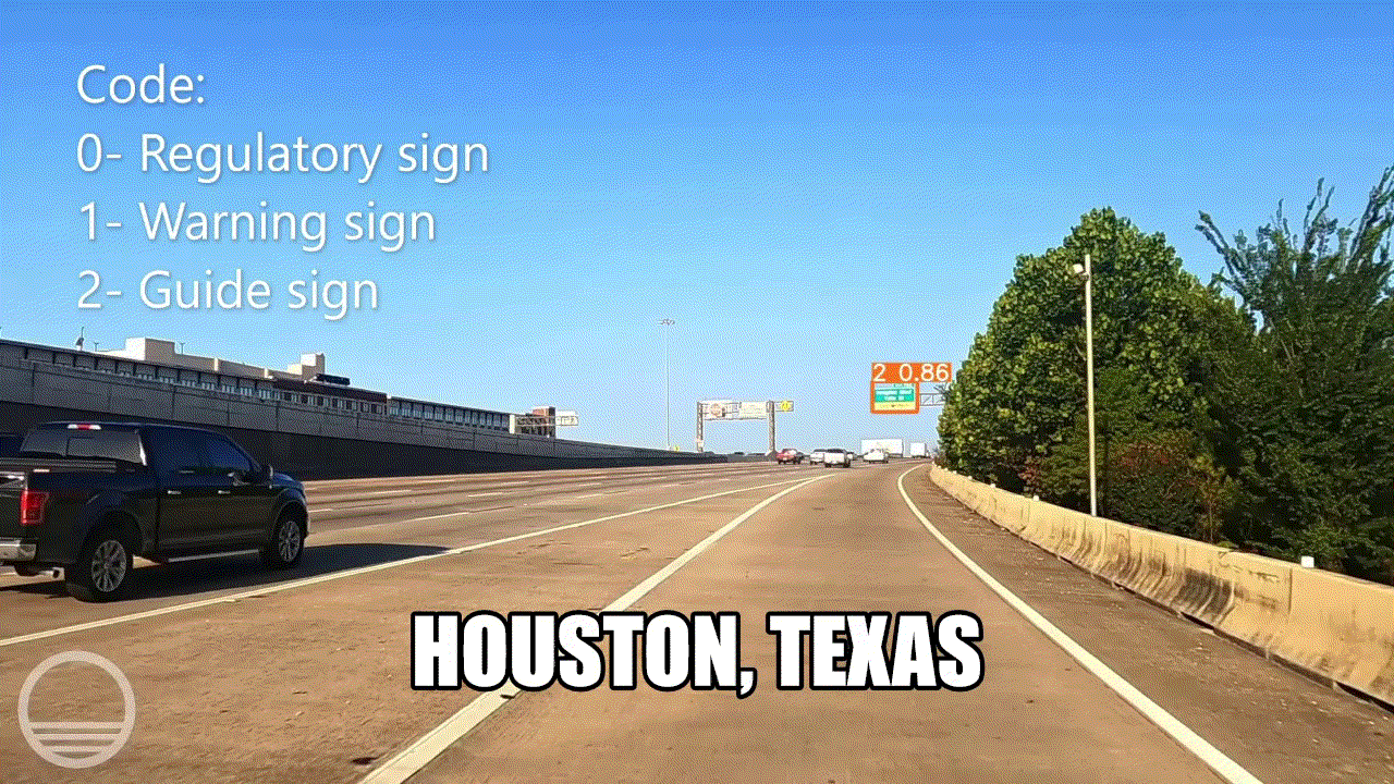
Automated road inventory detection
Main lab equipment
- HyMIT 3D Pavement Survey System has 3D pavement surface image sensors with 4K resolution, a laptop computer, and 3D real-time control and image processing software. This system is essential for 3D pavement surface image capture, rut depth measurement, distress data process and display, and data management.
- HyMIT High Speed 3D Inertial Road Profiler with 2K resolution has longitudinal and transverse profiling system. This profiler can display the profile in real-time while data is being collected. This profiler can also calculate profile index (PI), international roughness index (IRI), half-car roughness index (HRI), ride quality index (RQI), ride number (RN), and texture. This profiler meets or exceeds the following requirements: ASTM E950 Class I profiler specifications, AASHTO PP 51-02, and Texas test method TEX 1001-S.
- AMES GPS_DMI Pro sensor with multi-channel counter and timer for multiple trigger signals. The Distance Measurement Instrument can measure pavement distances, replacing traditional encoder-based DMI systems.
- Stereo vision cameras can be installed in the data collection vehicle to capture the right-of-view image for road inventory data check.
- A Ford E-350 installed with equipment a-d for pavement condition survey. This survey vehicle can collect cracking, rutting, roughness, and road inventory data in highway speed.
- Sony α7R II Camera has a back-illuminated 42.4 MP 35 mm full-frame CMOS image sensor to collect high-resolution images as well as a Fast Hybrid AF and 5-axis image stabilization to reduce the noise information and improve the image quality. The collected high-resolution images are essential for 3D image reconstruction using the Research Team designed 3D reconstruction algorithm.